
Kettle Moraine State Forest in eastern Wisconsin covers 30,000 acres.
A long time ago, the area was covered in glaciers. A moraine is an accumulation of glacial debris, such as rocks and silt. Kettles are landforms molded by melting glaciers.
Lapham Peak was formed about 10,000 yrs ago by a glacier which made it the highest point in Waukesha County with a elevation of 1,233 ft above sea level. At the top is an observation tower (45 ft tall). In the late 1800’s the Federal Signal Service Division of Telegrams and Reports established a signal station on the peak to receive meteorological observations from Pike’s Peak, Colorado. Increase A. Lapham collected the data and relayed it to all the Great Lakes ports to warn them about approaching storms.
Lapham Peak now encompasses over 1,000 acres of cross country ski trails and other recreational activities.
As we entered the area we came upon a deer standing stock still looking right at us as if we had lost our mind. It was beautiful.


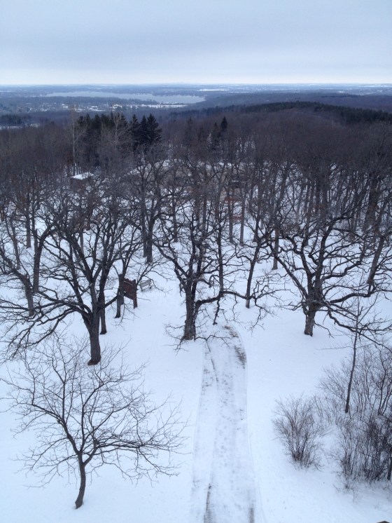


This is what 12 degrees F looks like.
Thanks for sharing some snow!
You are welcome! I am loving it.